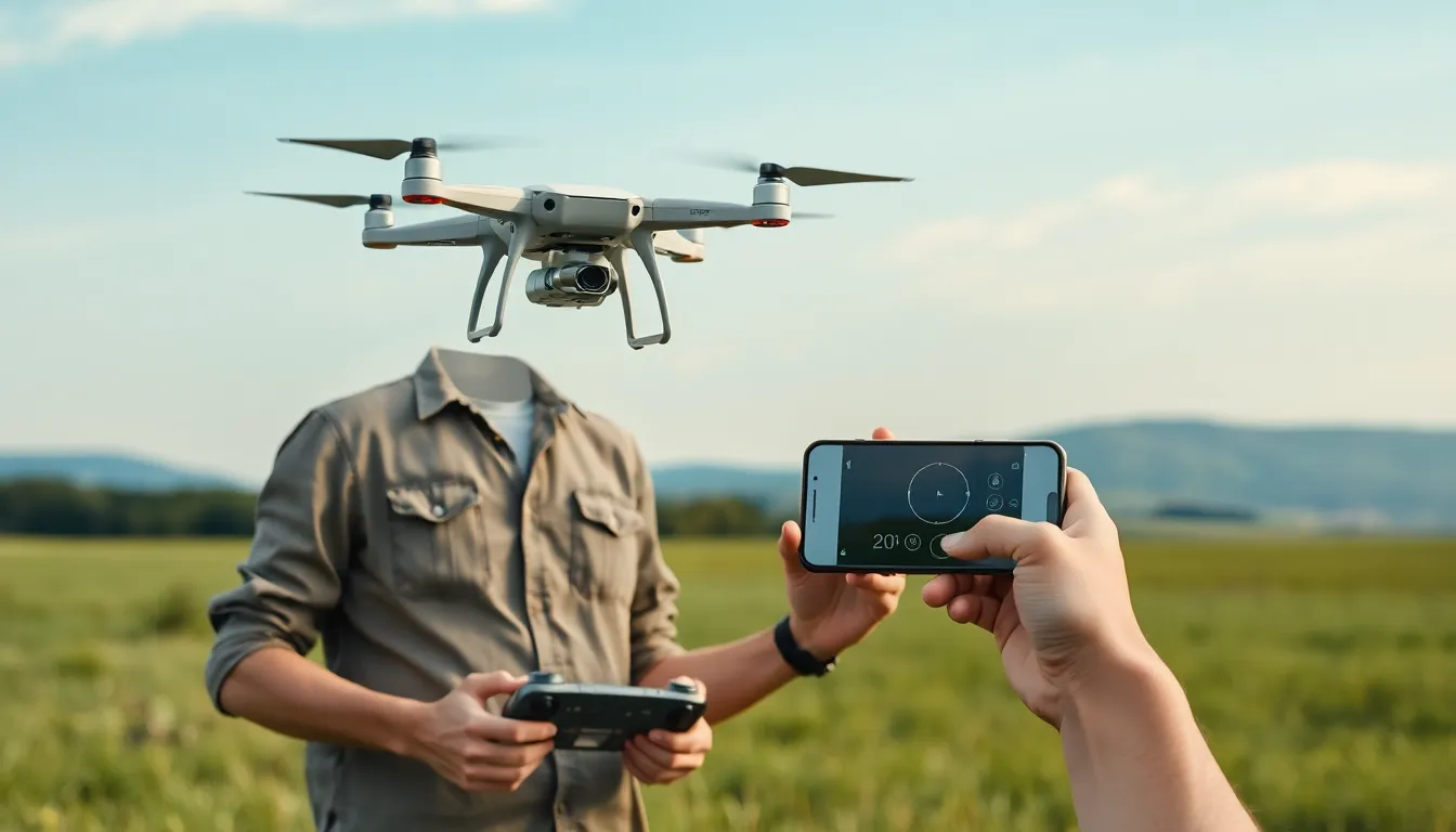
Drones have taken the skies by storm, but not all of them are free to roam wherever they please. Enter geofencing, the digital leash that keeps these flying machines from becoming rogue adventurers. Imagine a drone trying to crash a wedding or photobombing a family picnic—geofencing ensures that doesn’t happen.
With this clever technology, drones can be programmed to stay within designated boundaries, making them safer and smarter. It’s like giving them a virtual GPS collar that says, “Stay in your lane, buddy!” As the popularity of drones continues to soar, understanding geofencing becomes essential for both hobbyists and professionals. Buckle up as we dive into how this innovative feature is transforming the way we use drones, ensuring they both entertain and comply with regulations.
Overview of Drones With Geofencing
Drones equipped with geofencing technology create virtual boundaries that enhance operational safety. Users can establish designated flight zones, preventing drones from entering restricted areas like airports or sensitive private properties. This capability significantly reduces the risk of accidents and legal issues.
Many manufacturers implement geofencing in their models, ensuring compliance with local regulations. For instance, DJI, a leader in the drone industry, incorporates geofencing in their products, alerting users when they try to operate in no-fly zones. Operators receive real-time notifications regarding their drone’s location in relation to these digital barriers.
Additionally, geofencing provides flexibility for commercial applications. Companies can program their drones to operate within specified geographic limits, catering to delivery or surveillance needs while avoiding interference with surrounding activities. This feature is particularly beneficial for industries like agriculture or construction, where drones survey land or monitor operations.
Drones equipped with advanced geofencing also allow for user customization. Operators can adjust boundaries based on changing requirements, adapting to diverse environments. Custom settings enable modifications for temporary events or specific tasks, contributing to operational efficiency.
Drones with geofencing contribute to a safer aerial environment while providing flexibility for varied applications. The integration of this technology elevates safety protocols and compliance, making it essential for drone enthusiasts and professionals alike.
How Geofencing Works in Drones
Geofencing creates virtual boundaries that guide drone operations by preventing access to restricted areas. This digital boundary system is crucial for ensuring safety and compliance within regulated airspaces.
Definition of Geofencing
Geofencing refers to a location-based service that uses GPS or RFID technology to define specific geographical areas. Drones equipped with geofencing software can recognize these defined zones and respond automatically when approaching them. By marking off safe and restricted areas, operators ensure that drones cannot stray into prohibited spaces, such as airports or private properties. This functionality enhances operational safety and protects against potential legal issues.
Technology Behind Geofencing
Geofencing relies on GPS technology to create and manage virtual boundaries. It uses geolocation data to determine a drone’s position relative to the set perimeters. When a drone approaches a defined boundary, the onboard system triggers alerts or initiates pre-programmed actions, such as returning to a safe zone or ceasing flight. Many modern drones integrate sophisticated software that allows for real-time updates of these boundaries. Enhanced algorithms ensure accuracy in boundary detection, improving the overall effectiveness of geofencing in varied operational contexts.
Benefits of Drones With Geofencing
Drones equipped with geofencing technology offer significant advantages for users. These benefits encompass enhanced safety measures, regulatory compliance, and operational efficiency.
Enhanced Safety Measures
Drones utilize geofencing to create virtual barriers that enhance safety. Operators can set designated flight zones, preventing drones from intruding into restricted areas like airports or private properties. Notification systems alert users when their drones approach these boundaries, greatly reducing accident risks. Such proactive measures ensure that operators navigate their drones within safe confines. The result is a considerable decrease in potential accidents and legal complications.
Regulatory Compliance
Regulatory compliance stands as a critical advantage of drones with geofencing. Compliance becomes seamless as manufacturers program no-fly zones into drones, aligning with guidelines set by aviation authorities. Operators receive real-time alerts for regulatory boundaries, allowing them to adjust flight paths accordingly. Adhering to local laws promotes responsible drone usage, significantly reducing penalties and fines. Ultimately, drones with geofencing help maintain industry standards, making them valuable for both hobbyists and professionals.
Operational Efficiency
Operational efficiency is enhanced through geofencing, particularly for commercial applications. Businesses can program drones to operate within specific geographic limits for various tasks such as delivery and surveillance. Customizing boundaries enables companies to optimize workflows while avoiding disruptions from neighboring activities. The flexibility provided reduces downtime, increasing productivity levels. As drones adapt to changing operational needs, organizations maximize their investment in drone technology.
Applications of Drones With Geofencing
Drones equipped with geofencing technology find diverse applications across various industries. This technology enhances operational safety while adhering to regulations.
Agriculture and Farming
Drones play a significant role in agriculture and farming by monitoring crop health and optimizing resource usage. They can be programmed to conduct flights within defined boundaries, ensuring they avoid sensitive areas like livestock zones or private properties. Farmers benefit from data collected on crop conditions, helping them make informed decisions. In addition, geofencing allows operators to prevent drones from straying into areas where they could cause disruption or damage. This capability proves crucial for improving crop yields and increasing operational efficiency.
Infrastructure Inspection
Infrastructure inspection relies on drones to assess the condition of structures such as bridges, power lines, and pipelines. Geofencing enhances the safety of these operations by restricting flights to specific zones, minimizing the risk of accidents in crowded areas. Inspectors can quickly gather data without jeopardizing nearby activities or infringing on private property. The technology also allows drones to notify operators when approaching restricted areas, promoting adherence to safety protocols during inspections. Effective management of these operations leads to timely maintenance and improved safety standards.
Search and Rescue Operations
Search and rescue missions benefit from the precision of drones with geofencing capabilities. Operators can define safe flight zones to navigate complex terrains effectively, maintaining control over drone movements in emergencies. Geofencing prevents drones from entering hazardous areas, ensuring operational safety while searching for missing persons or assessing disaster situations. Real-time data gathered from drones enables efficient coordination of rescue efforts. By focusing on designated areas, responders can enhance response times and dramatically improve overall mission success.
Challenges and Limitations
Drones with geofencing technology face several challenges and limitations that affect their performance and usability.
Technical Limitations
Technological constraints impact the effectiveness of geofencing in drones. GPS accuracy can vary, leading to incorrect boundary detection. In urban areas, signal interference from buildings often disrupts geolocation data. Battery life limits flight time, restricting operations within programmed zones. Software bugs occasionally affect the responsiveness of geofencing features. Manufacturers regularly update their systems, yet not all users apply those updates. These factors can hinder the overall reliability of geofencing, making operators cautious in complex environments.
Regulatory Hurdles
Navigating regulatory challenges is essential for drone operators utilizing geofencing. Local laws regarding airspace and drone usage often vary significantly. Compliance with federal regulations, like those established by the FAA, can become complicated due to changing guidelines. Some regions impose stricter restrictions on drone flights, affecting operational flexibility. Additionally, many areas lack clear communication about no-fly zones, leaving operators unaware of prohibited spaces. These regulatory uncertainties could result in inadvertent violations, emphasizing the need for clear and comprehensive legal frameworks.
Drones with geofencing technology represent a significant advancement in ensuring safe and compliant operations. By establishing virtual boundaries, these drones enhance safety for both operators and the public while adhering to regulatory requirements. As industries continue to adopt drone technology for various applications, the importance of geofencing becomes increasingly apparent.
With the ability to customize flight zones, businesses can optimize their workflows and minimize risks. Despite some technical challenges and regulatory complexities, the benefits of geofencing far outweigh the drawbacks. As the technology evolves, it promises to play an integral role in shaping the future of drone operations across multiple sectors.